search.ch

Furka-Höhenweg

Regional route No. 51, Oberwald–Furkapass
  • Image 1

Description

Regional route
No. 51 (Oberwald–Furkapass)
Length
11 km
Ascent • Descent
↑ 1200 m • ↓ 140 m
Lowest point • Highest point
1364 m • 2430 m
Hiking time
4 h 30 min
Grade
medium (mountain hiking trail)
Fitness level
difficult
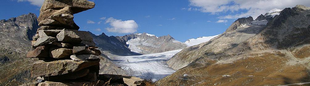
Follow the infant river Rhone to Gletsch and then continue towards the Furka Pass, with the historic Furka railway line alongside you. If you're lucky, you'll see a traditional steam train passing by. Striking views of the Rhone Glacier and the entire Goms valley.

Height profile

Weather:

Comments about this activity or place?

Thank you for your feedback!