search.ch

Freiburger Voralpenweg

Regional route No. 78, Plaffeien–Schwarzsee
  • Image 1

Description

Regional route
No. 78 (Plaffeien–Schwarzsee)
Length
10 km
Ascent • Descent
↑ 340 m • ↓ 140 m
Lowest point • Highest point
831 m • 1047 m
Hiking time
2 h 45 min
Grade
easy (hiking trail)
Fitness level
easy
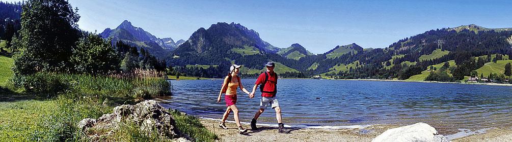
A continuous, gentle ascent leads across extensive flower meadows to the banks of the Sense. It is considered one of the last wild rivers in the Alpine region, and the WWF named it the most beautiful river in Europe. Past the Rohrmoos fen and amphibian spawning ground, the trail leads to Schwarzsee lake, inviting you to take a dip between wooded hills.

Height profile

Weather:

Comments about this activity or place?

Thank you for your feedback!