DE
FR
IT
EN
Directory
Weather
Map / Route
Timetable
Leisure
TV guide
Cinema
Web search
Apps
More
Personal Data »
Login:
Register
Password forgotten
or
Log in with local.ch
Log in with Apple
Log in with Facebook
Log in with Google
Log in with LinkedIn
Please note that our new
privacy statement
as well as the revised
terms and conditions of use
apply.
Leisure
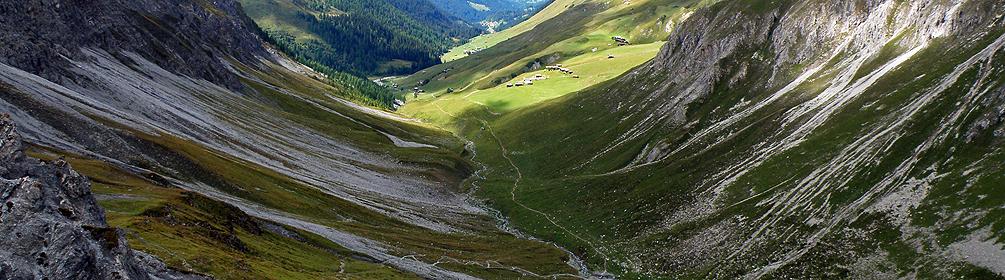
Mountain bike in Obersaxen Mundaun
Graubünden Bike
Regional route No. 90, Lumbrein–Trun
Description
Regional route
No. 90 (Lumbrein–Trun)
Length
28 km
Ascent • Descent
↑ 900 m • ↓ 1450 m
Lowest point • Highest point
833 m • 2079 m
Grade
medium
Fitness level
medium (opposite direction: difficult)
The route winds leisurely up through the typical meadow slopes of the seemingly untouched «Tal des Lichts» (Valley of Light) to the gentle pass into the Surselva. The descent to Trun leads via St. Martin on the sun terrace of Obersaxen.
Comments on this information?
We welcome your feedback!
Presented by
Route
Height profile
Weather:
More...
Comments about this activity or place?
Incorrect information
Missing information
Another topic
Thank you for your feedback!
Close